Service Objects’ Address Geocode – International provides accurate and reliable geocoding for addresses across the globe. Whether you need to convert addresses into geographic coordinates (latitude and longitude) for mapping, routing, or spatial analysis, our service ensures you have the precise data you need to make informed decisions.
Additionally, our service supports reverse geocoding, allowing you to convert geographic coordinates back into readable addresses, enhancing your location intelligence capabilities.
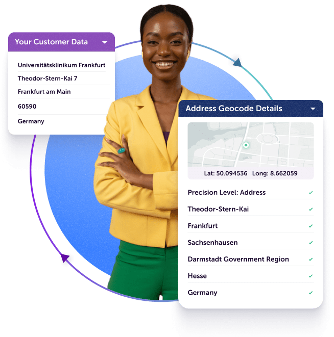
Transform global addresses into accurate latitude and longitude coordinates with up to 16 levels of precision, essential for detailed mapping and spatial analysis. The service also returns Bing and Google Map URLs, and place names for enhanced usability.
Advanced Reverse Geo-location
Decode geographic coordinates back into formatted addresses, adhering to local postal conventions for global accuracy.
Extensive Global Coverage
Geocode addresses in over 250 countries and territories, enabling worldwide reach and insightful decision-making.
For U.S. addresses that are street-level matches, additional data includes whether the area is unincorporated, state FIPS, County FIPS, Census tract, census block, census geoid, congress code, state legislative district upper (senate) code, and time zone.
AI-Ready Data
Ensure the accuracy of geolocation data for use with AI applications, enhancing predictive analytics and decision-making. Provides comprehensive real-time data, including precise longitude and latitude in decimal format, and appended postal codes.
How Address Geocode – International Works
Returns Geo-Coordinates from Input Address
Provided addresses undergo correction and standardization through Service Objects’ world-class Address Validation engine, ensuring high address accuracy and match rates, followed by conversion into precise latitude and longitude coordinates.
Supports Reverse Geo-Coding to Address
We translate latitude and longitude coordinates into validated addresses formatted correctly for each country.
Cascading Logic Delivers Highest Resolution
Returns precise details including 16 levels of precision such as points of interest (POI), street-level, locality, administrative area, postcode, and country.
Multilingual Support
Handle addresses in most languages, enabling accurate geocoding and reverse geocoding across diverse linguistic contexts. This feature ensures that language barriers do not impede the precision and reliability of your location data.
Experience Unmatched Reliability
99.999%
Uptime Guarantee
24/7/365
Customer Support
Dedicated
Support Engineers
Features and Benefits of Address Geocode – International
Enables Accurate Pick-up and Delivery
Address Geocode – International harnesses 20 years of address expertise to deliver real-time, precise results globally.
Validates addresses and geo-coordinates using authoritative postal and spatial data.
Utilizes advanced artificial intelligence to enhance match rates and accuracy worldwide.
Offers flexible outputs tailored to meet postal addressing conventions in every country.
Returns Additional Location Intelligence
Geocode – International provides extensive capabilities tailored to each country’s data sophistication:
Delivers 16 levels of precision, including points of interest (e.g. Eiffel Tower)
Returns detailed information such as locality, administrative area, postal code, and country.
Facilitates accurate point-to-point distance calculations for shipping logistics and insurance risk assessment.
Generates custom mapping URLs compatible with popular mapping tools.
We use cookies to enhance your browsing experience.
Cookies, tracking pixels, and similar tech are small data files served by our platform and stored on your device. They help with site operation, personalization, and may track your usage for targeted ads on other sites.
By using our site, you agree to our cookie use.
Third-party services may also deploy cookies, including Google, Facebook, and others. These services collect anonymous data like IP addresses and device IDs for analytics and site functionality.