What does it mean to geocode? Our DOTS Address Geocode – US web service provides latitude and longitude coordinates along with other metadata information about a physical US address. This includes information such as demographics, census tract, census block, and other metadata information. We also offer geocoding services for Canadian addresses. In this article, we’ll take a look at how to interpret the core geographic data they return.
Understanding match levels
The core functionality of our recommended operation, GetBestMatch_V4, takes in an input address and returns latitude and longitude coordinates. More importantly, it returns a resolution level that tells you how accurate these values are. At the maximum resolution level, the latitude and longitude coordinates can consist of 10 digits, with a maximum precision of up to 7 places after the decimal point. At this highest level of resolution, we provide coordinates for a street level property match.
To better understand the web service response, we can first look at the various resolution level codes that can be returned. Below are the possible return codes that indicate the level at which the input address was matched:
| Code | Match Level |
|---|---|
| S | Street Level Property |
| P | ZIP+4 |
| R | ZIP+3 |
| T | ZIP+2 |
| N | ZIP+1 |
| Z | ZIP code |
| C | City/State |
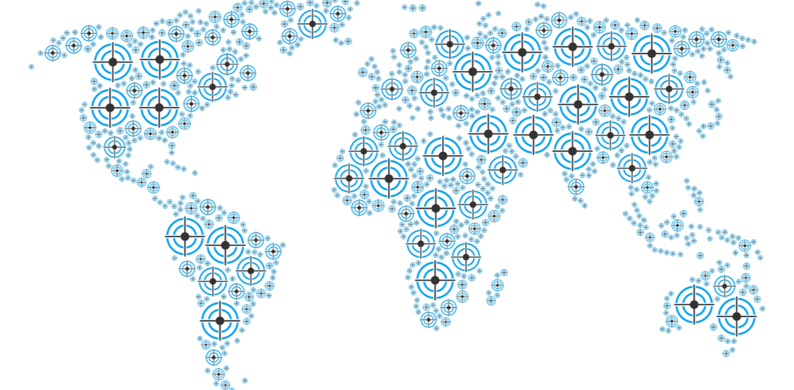
The list above can be thought of like a bullseye target, where each resolution level represents a concentric ring, coming closer to the center/target. (NOTE: Although the bulls-eye metaphor is helpful for visualization, it can lead to a misunderstanding as the levels are not perfectly spaced between one another.) For example, the centroid for a city will be in respect to the entirety of the city’s shape. As the resolution level increases the lat/long centroids will hone in on the address’s physical location, which may be off-center from the city level centroid. The latitude and longitude coordinates for each of the resolution levels represents the centroid for the given area it represents.
What is a centroid?
A centroid is the central point of a shape or figure. It is this point that is the mean position of all points within the figure. In the bullseye metaphor, the centroid is the innermost circle. For map data, the centroid represents the average position within the confines of the city/state, zip, or street boundaries. Using our business address as an example, the following city level centroid: all points within the boundary of the city are averaged and the resulting singular point represents the centroid.
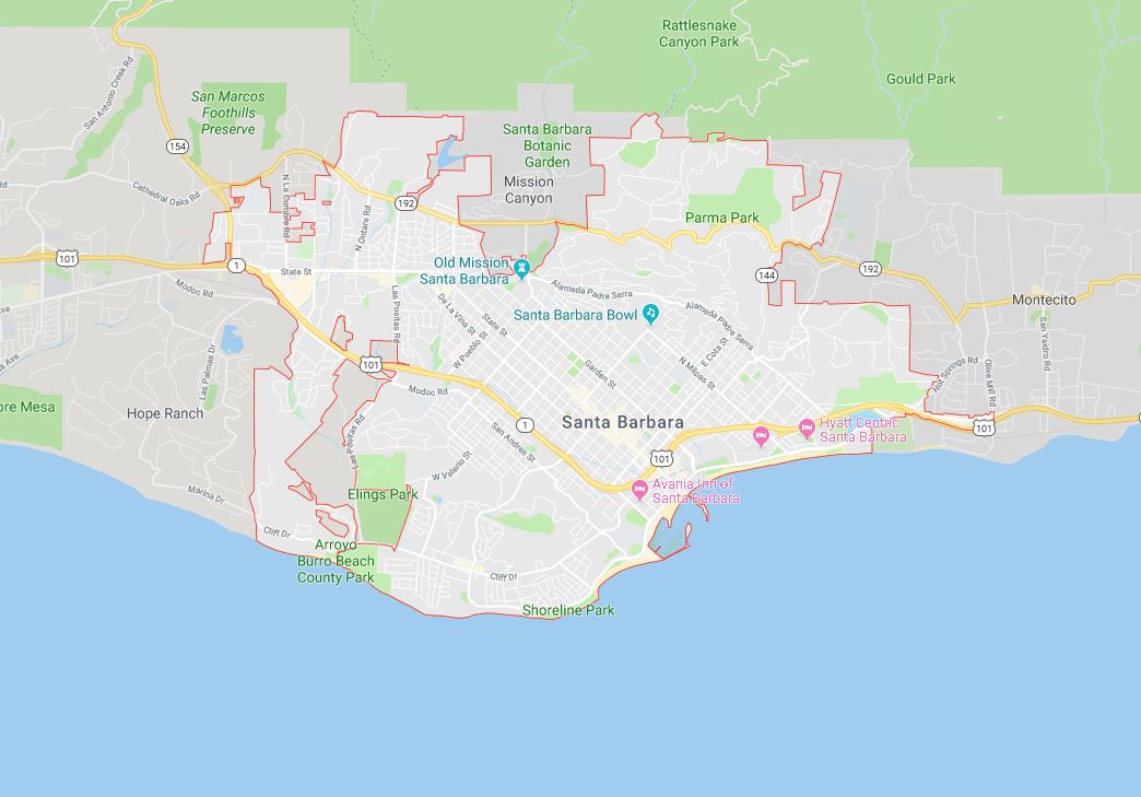
Below is the actual shape of the boundaries that define the City of Santa Barbara.
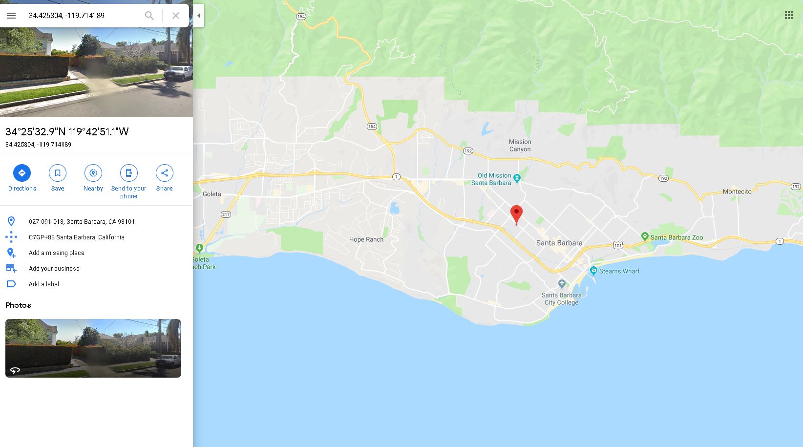
And this image shows the geometric center for city-level match (34.425804, -119.714189), our C Level Match.
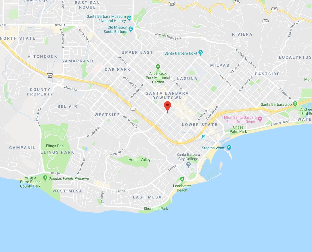
Here you can see how the Z level Match (centroid for ZIP level match, 34.419120, -119.703421) is getting closer to our location.
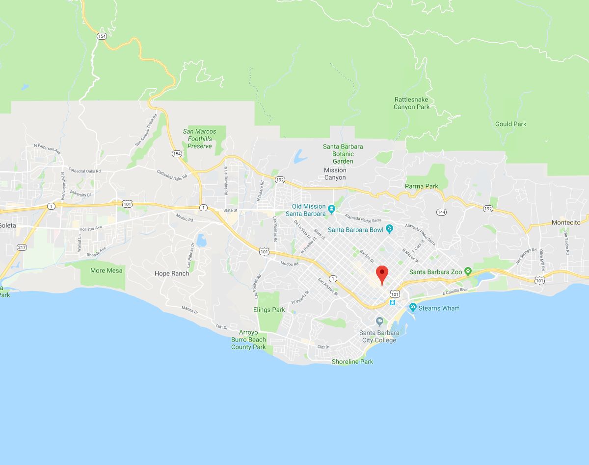
And at the highest resolution, S Level Match, we see a centroid for street premise level match at 34.418014,-119.696477.
This is our address’ physical location.
What affects the gecode resolution level for an input address?
The service will work to the best of its ability to find an “S – Street Level Property match” for an input address. However, this precise resolution level is not always possible to obtain. Aspects such as bogus data, misspellings, and data disparities can affect the web service response. If your input address cannot be cross-validated with our USPS and Census data, a lower level resolution level will be returned. The service will not make extreme alterations to your input address or make far-reaching guesses in order to return an S level match.
How to interpret the match levels
The match level code indicates what the service’s output latitude and longitude pertain to. For example, the C level code indicates that the latitude and longitude are at the City level. All of the points within the city boundaries were averaged out and the lat/long returned represents the geometric center of the city. Each subsequent resolution level represents a decrease in the size of the boundaries and thus, an increase in the accuracy of the lat/long. At its most accurate resolution level, DOTS Address Geocode – US will provide a 10 digit lat/long street-level coordinate for the premise.
So as you can see, geocoding an address is not an exact science: it depends on the specific address data we are working with. But with Address Geocode – US, you will get the most accurate latitude and longitude data we can provide, together with data that allows you to understand and process the level of geographic data that is returned to you.