[dropshadowbox align=”center” effect=”horizontal-curve-bottom” width=”auto” height=”” background_color=”#ffffff” border_width=”1″ border_color=”#dddddd” rounded_corners=”false” inside_shadow=”false” outside_shadow=”false” ]Important Notice: Over the past year, it has been our honor to provide enhanced COVID-19 case data to researchers and data scientists. At Service Objects, we embrace our social responsibility and recognize that we are in a unique position to help due to our superior address and geolocation data. In order to move on to the next community-driven project, we have decided to deprecate the COVID-19 data set, and all versions will be removed from our website permanently on March 9, 2021.[/dropshadowbox]
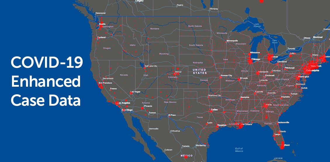
Data always plays a critical role in the ability to research, study, and combat public health emergencies. This is especially true in the case of a global crisis. Access to datasets is increasingly essential to the research process and is particularly necessary for the global response to the COVID-19 viral pandemic. In response to the pandemic, Service Objects has built an enhanced dataset of COVID-19 cases nationwide to assist in identifying trends that could help combat this deadly virus.
The current data provided by Johns Hopkins University is missing key elements for scientists that study COVID-19. To create a more complete dataset, Service Objects is using our authoritative datasets to dedupe, cleanse and append over 200 additional data points to significantly enhance the case data.
Like a number of companies across the U.S., Service Objects was quick to recognize the critical need for a clean and enhanced dataset for researchers and data scientists to analyze and make informed decisions. Providing accurate location intelligence and geographic data, a key ingredient in this enhanced COVID-19 dataset, is what we do best.
The COVID-19 crisis is challenging all businesses to leverage their core competencies to pitch in and help in any way they can. At Service Objects, we embrace our social responsibility and recognize we are in a unique position to help due to our superior data. We are all in this together and we are committed to providing researchers the data they need to model the progression of this outbreak.
What types of data are included in the file?
COVID-19 case data is generously provided by the 2019 Novel Coronavirus Visual Dashboard operated by the Johns Hopkins University Center for Systems Science and Engineering (JHU CSSE). Country census data and demographic information is provided by the United States Census Bureau. Climate data is provided by the National Oceanic and Atmospheric Administration (NOAA).
County data, published by Johns Hopkins University and available since January 2020, provides a more localized picture of COVID-19 distribution. The county-level data is generated from a dataset known as Novel Coronavirus (COVID-19) Cases and is the foundational dataset for studying COVID-19 across larger geographic areas. Currently, there are 3,141 counties or county-equivalents across the United States.
Nationwide county-level data provides an additional resource to assist in monitoring the state of the COVID-19 pandemic. County data elements currently consist of case count, deaths, geographic, demographics, average temperature, humidity, maximum and minimum temperature, and county-level precipitation.
County-level data provides specific information that is useful for data scientists, managers, researchers and business leaders. For instance, a nationwide medical supply company can use county-level COVID case data and population data to predict future demand by region. This dataset is county-level and does not contain any personally identifiable information (PII).
Contact us
Service Objects regularly receives a variety of requests from businesses and users around the country in which the finer-scale location data is helpful. For information about higher resolution data, contact us today!