
The US Census Bureau uses the term “place” to refer to an area associated with a concentrated population, such as a municipality, city, town, village or community. These statistical areas have a defined boundary and they may or may not have a legal administration of power that performs some level of government function. The US Census Bureau uses class (CLASSFP) codes to classify different types of places and areas. The Bureau currently lists 70 different CLASSFP codes; however, all places are either a legally incorporated place or a Census Designated Place (CDP).
Incorporated place
The US Census Bureau defines an incorporated place as a geographic area with legally defined municipal boundaries under the laws of the state in which it is located. Incorporated places are established to provide governmental functions for a population, typically with elected officials and the means to provide local municipal services such as water, sanitation, schools and police departments. Each state has its own requirements for incorporation that typically include population and land area thresholds.
Census Designated Place (CDP)
A Census Designated Place (CDP) is the statistical counterpart of an incorporated place. In general, CDPs are not legally incorporated under the laws of the state in which they are located, nor do they have elected officials to serve governmental functions. Municipal services for CDPs are normally provided by either the county, a minor civil division (MCD), or by a nearby incorporated place. A CDP is also commonly known or referred to as an unincorporated place.
Identifying incorporated and unincorporated places when geocoding addresses
The DOTS Address Geocode US service makes use of various datasets from the US Census Bureau. This data is compiled and organized into detailed street-level data and place wide boundary data. The street level data allows the geocoding service to know which side of the street the address is on. This lets the service know which block the address is on and it is helpful in some edge case scenarios where an address may fall on the edge of a boundary.
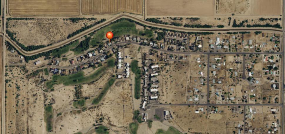
The sstreet-level data lets us do many things but it’s not always complete and it doesn’t always give us the whole picture. In some cases, there are addresses that reside in the outskirts of an area, outside of the incorporated boundaries. These locations are in the unincorporated areas of a minor civil division (MCD) or county. Detailed data for these unincorporated areas is often lacking, usually due to a combination of low population density and large land areas.
After the coordinates for an address have been determined, the service can then use them to determine if they fall in an incorporated place, unincorporated place, or outside of any place boundary and in an unincorporated area. This not only works for addresses in the outskirts of an area but for other situations as well.
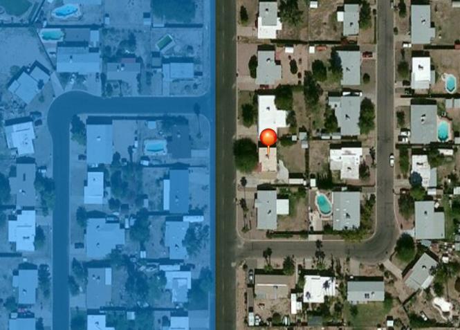
Sometimes there are small pocket communities that appear to be within a larger city area but they are not actually a part of it.
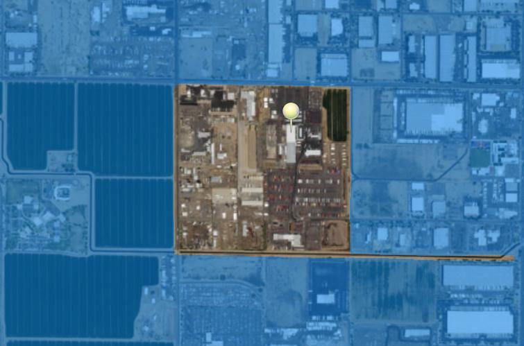
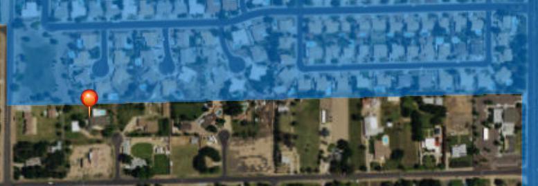
The US Census Bureau says that the boundaries of a place should be considered organic, as they can shrink and grow. In some cases, the boundaries of a place will not cleanly stop on the edge of a street or block. Sometimes the boundary will dissect part of a road or block partway, dividing neighboring structures.
Overall, there are many challenging scenarios that can arise when it comes to geocoding an address and determining if it is unincorporated or not. However, using the right data with the right tools and expertise means that we can overcome these challenges to provide accurate and reliable results to our clients.